Laisong Fm
Type Locality and Naming
Lowest formation of the Barail Gr (SE Bangladesh usage). Type section is in the Near Laisong Village along Jenam River. [Original Publication: Evans P. 1932. Tertiary succession in Assam, Trans. Min. Geol. Inst, India, vol.27, pp.155.]. Reference section: The Silchar-Haflong road section.
Synonyms: Liasong Sands. The arenaceous sediments overlying Disang Gr Shale were assigned to this formation, (Pandey and Dave, 1998).
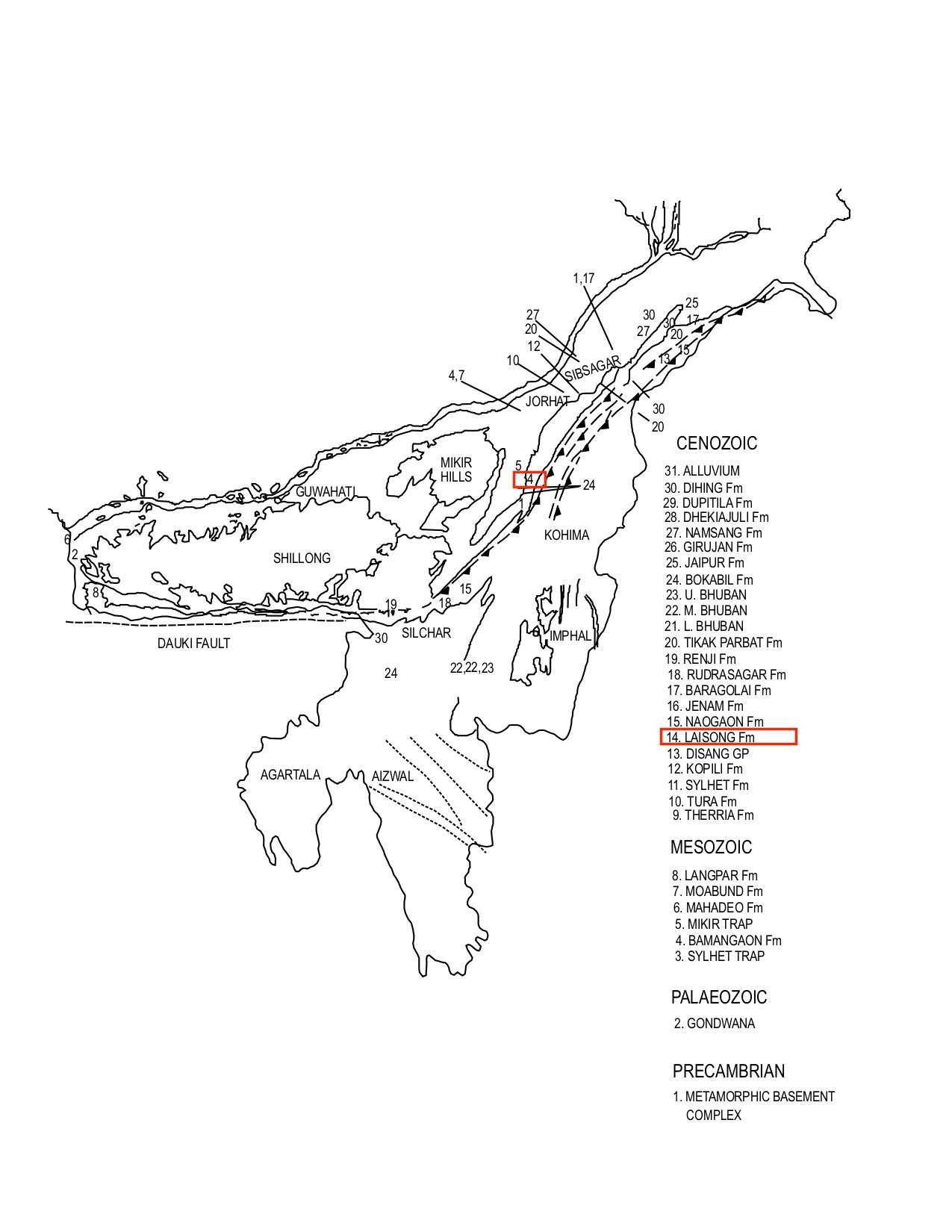
[Figure 1: Formation stratotypes of North East Basins (modified after Pandey and Dave, 1998)]
Lithology and Thickness
Clayey sandstone. Type section lithology: It consists of grey, thin- to thick-bedded sandstones with subordinate shale. Sandstone is light grey, fine to medium grained, current bedded. Shales are dark grey, with poor fissility, moderately hard, carbonaceous, occasionally with coal streaks. Reference section lithology: It consists of sandstone-shale alternations towards the base which grade upward into thick-bedded sandstones with thin shaly interbeds near the top. The sandstones are dark grey, fine grained, occasionally medium grained, hard, thin to thick bedded, sometimes flaggy. The shales are dark grey, moderately hard and compact, occasionally silty.
The thickness is 2500 m which decreases to the south and the west. In the southern limb of Jatinga anticline, it is 1755 m (Srivastava et al., 1968).
[Figure 2: Stratigraphic lithocolumn of the Laisong Formation measured at Yikhum village (Wokha) with ichnofabric distribution and inferred paleoenvironmental setting (after Lokho et al., 2018)]
[Figure 3: Stratigraphic lithocolumn of the Laisong Formation measured at Sechu-Zubza section (Kohima) with ichnofabric distribution and inferred paleoenvironmental setting. (after Lokho et al., 2018)]
Relationships and Distribution
Lower contact
Upper contact
Gradational contact with the Jenam Fm.
Regional extent
Khasi & Jaintia Hills, Naga Schuppen Belt, Tripura Cachar, SE Bangladesh: The predominantly sandy sequence of Laisong Formation outcrops in the southeastern part of Shillong Plateau, Fold belt of Cachar and southwest Schuppen Belt. Major outcrops are seen in the Kohima-Patkai fold belt. Towards southeast, a 25 km-wide belt of this formation is exposed to the west of Imphal (Das Gupta, 1977). In South Shillong Plateau it consists mainly of thinly bedded flaggy sandstone with shale, sandy shale alternations, whereas in Barail Range it gradually changes to medium to thick-bedded sandstones. In Schuppen Belt it is dominated by thick-bedded sandstones, interbedded carbonaceous shale and white kaolinitic clay bands.
GeoJSON
Fossils
Rao (1983) reported Nummulites chavannesi, Operculina sp., Biplanispira sp., from the Heningkungalwa and Kiphire areas of the Schuppen Belt. The palynofloral assemblage recorded from Laisong Formation in the Silchar Haflong road section is characterized by Cupuliferoiepollenites vulgaris, Meyeripollis naharkotensis, Tricolpites minor, Flurschuetzia trilobata, (Kumar, 1992). Baruah et al., (1987) reported sporadic arenaceous foraminifera from Laisong Formation of Barail Group near Heningkunglwa and Lotsu village, SW of Dimapur, Nagaland.
[Figure 4: Trace fossils from the Laisong Formation (Yikhum Section, Wokha) (d,h) Ophiomorpha isp. (scale bar=2 cm) (after Lokho et al., 2018)]
Age
Depositional setting
Brackish Water environment, Baruah et al., (1987).
Overall, the trace fossil assemblages and the primary sedimentary structures from the Laisong Formation of the Naga Hills indicate proximal hyperpycnal-delta-fed coarse grained turbidite in shallow-marine setting.
[Figure 5: Reconstructed model of the depositional system of the Laisong Formation in the Naga Hills (Nagaland), Manipur and Mizoram regions indicating a proximal to distal hyperpycnal-delta-fed coarse grained turbidite system. (after Lokho et al., 2018)]
Additional Information
The transition from Eocene to Oligocene was the most significant event in Earth’s history after the extinction of Dinosaurs during Cretaceous/Tertiary boundary. This is the time period when Antarctic Ice sheets begin to form. There were major extinctions in both plants and animals on the land and in the oceans. The study from this horizon may reveal many more information of the geological past like the fauna and flora extinctions and paleoclimate studies.

.jpg)
.jpg)
 (d).jpg)
 (h).jpg)
.jpg)